Friday, September 10, 2021

Black Balsam Knob and Tenant Mountain (Unfinished Business on the Art Loeb Trail)

Black Balsam Mountain

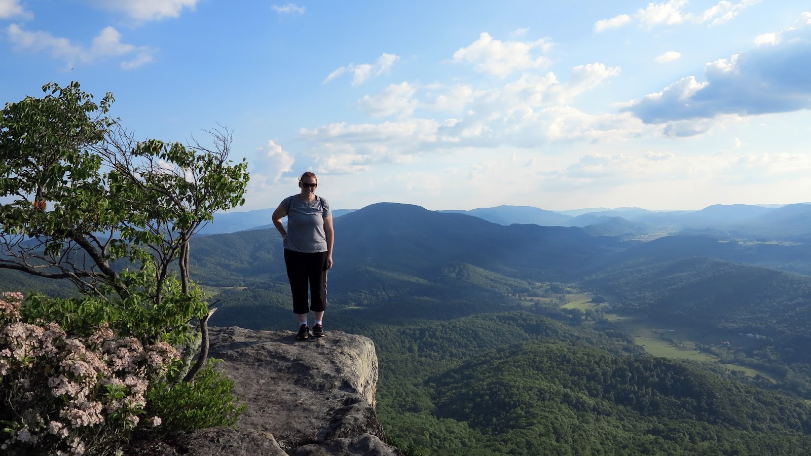
So Back in May of 2018 I had planned to backpack the entire Art Loeb Trail. It was on that hike that I learned why this area is considered the rainiest area in NC! It felt like constant thunderstorms would roll in during the morning, afternoon and at night. On the second day I was so exhausted from the storms through out the night, that I decided to bypass going up Tenant Mountain and Black Balsam Knob (two easy 6,000 footers). I kicked myself everyday since then because the views from there are supposedly the best in NC (It was shrouded in the clouds at the time, so I think I was justified)  Anyways, 3 years later and I finally decided to get back to the Art Loeb Trail and finish what I started a back in the rainy weekend of May.

My drive to the trail head took me through the blue ridge parkway. Stratus clouds were slowly climbing up the mountains. Made for a beautiful sunrise.


I arrived at the Sam Knob Trailhead completely covered in fog. I saw a text from my wife saying our son, couldn't go to daycare because he had a fever. I had no cell range at the lot, so I decided to head up to Black Balsam Knob, and see if I can call her there. It worked and she told me our son threw up, but that I should continue on with my hike (I was about 2.5 hr drive away from home). So I did.

So, back on the Art Loeb Trail and completly covered in clouds, except for a few openings here and there. Almost the same expereince as last time, though I didn't have the impending fear of another thunderstorm rolling in. Just hiking high in Southren Highlands in the clouds...I can dig it.


 Eventually, I crossed both summits of Tenant Mountain and Black Balsam Knob. I eventually hit the Investor Gap Trail, which took me back to my car. It was there at my Car that I realized there was another little bit of the Art Loeb trail that bypassed on first hike. From the Art Loeb Spur trail intersection to the Art Loeb trailhead parking lot. So trudged up the Spur trail again, and this time headed south. There I finally completed the Art Loeb Trail!

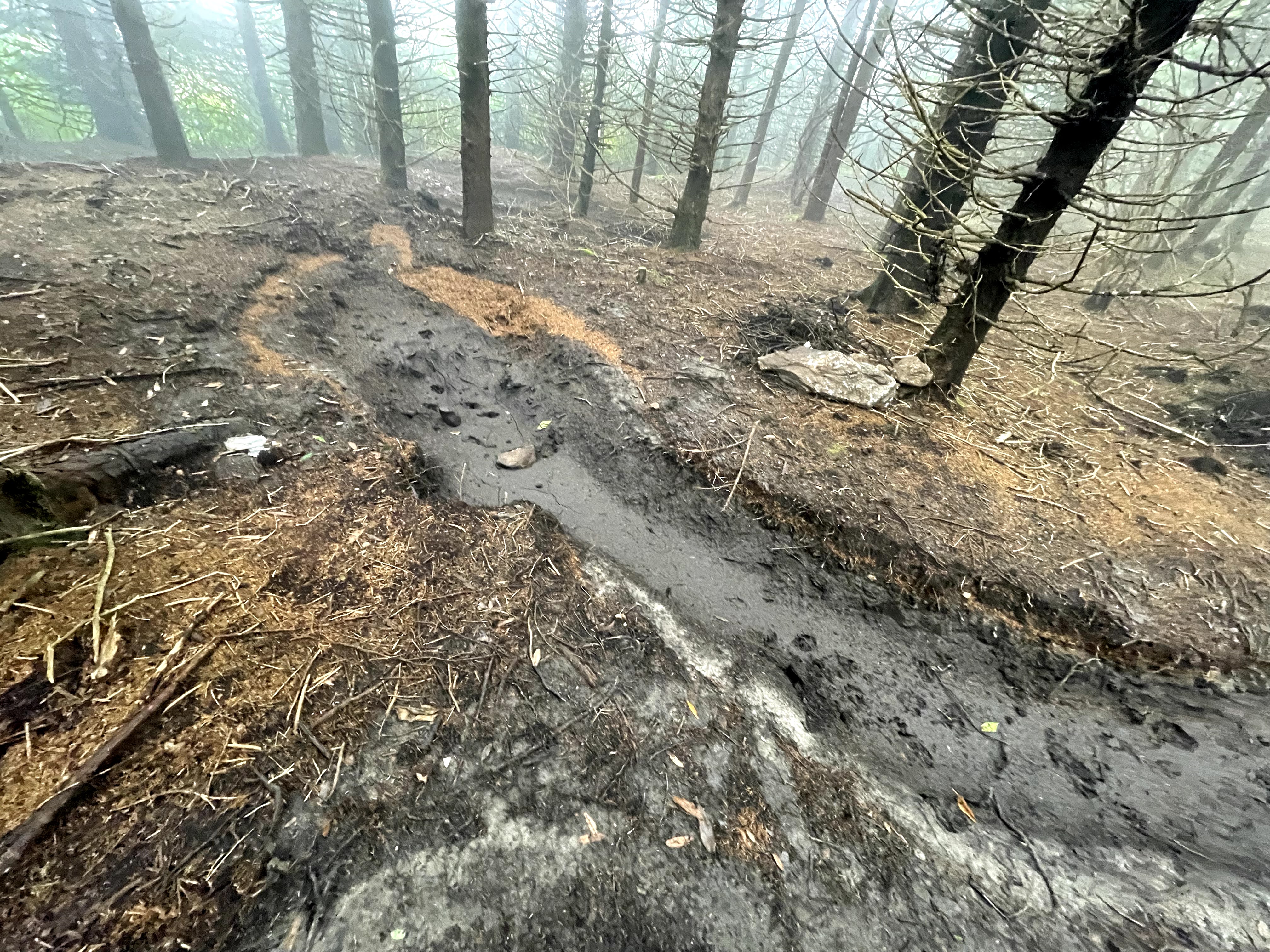
With the Art Loeb completed, I decided to continue on the MST/Art Loeb Trail and loop back to the Sam Knob Trailhead. It was only 6 miles extra, and I would be able to bag Sam Knob (another 6,000 footer). As I hiked a long, I saw some cool wash outs from TS Fred.


Once I reached the point where the Art Loeb and MST left each other, I had hit a wall. My feet were killing me. It's been a while since I've hiked like this. Also the tail just went straight down a bunch of slick rocks. I wasn't in the mood to finish hiking the loop, so I back tracked. All the way to my car. But along the way I took some cool shots of the area.


Anyways I was able to get home in time to pick up our other son from daycare (who was also getting sick) and pick up some za. I am really grateful for my wife taking care of our sick son, while I got go out and hike. She knew how much this hike meant to me, and she sacrificed a day of work so I could do this. It is something special when the one love is really looking out for you! Thanks, Babe!

Photo Album

Thursday, December 22, 2016

2016 Hiking Review in Pictures

2016 was a great year for hiking. Gini and I got to explore so many new regions, and visited some old favorites. I was able to return to my old stomping grounds of the Laurel Highlands in western PA. Gini got experience her first backpacking adventure. And Gini and I got engaged ontop a beautiful granite rock formation on The Preist.

So, let's hear it for the great adventures of 2016! Click the links to take you to photo albums from the hikes. Enjoy!

Jan 2 - Old Rag


Jan 30 - Styles Falls


Mar 26 - Rapidan Camp


Apr 2 - Cole Mountain


Apr 27 - Goshen Pass  


Jul 1 - The Priest


Jul 30 - Roan Highlands


Oct 30 - Mt Pleasant


Other hikes not listed:

Rough Mountain Wilderness Bushwhack
Mountain Lake
Grassy Knoll
Golden Gate Area near San Fransico
St. Marys Wilderness
Chattahoochee National Recreation Area, GA

Wednesday, November 30, 2016

Grayson Highlands


Grayson Highlands and Mt Rogers have always been my favorite spot to backpack in VA. I always wanted to do a post about it, but just never got around to it...till now. I realize the size and scope of Grayson Highlands is really hard to write about in post. In fact Gini's and my hike this weekend barely scratched the surface of all the great things this place has to offer. So this post will be just about our hike, but make no mistake, you can easily make your own backpacking loop and view more of the wonderful sights that we witnessed. Now without further ado, the Grayson Highlands Backpack.

So first we started from the backpacker's lot in Grayson Highlands State Park. 


There was a bit of a backup getting into the park, and the parking lot was almost full. But we managed to find a spot. Seeing as how many cars where in the lot, we grew concerned about how crowded the area might be. But, the number of people we saw wasn't that big of turn off.

We began hiking by crossing Massie Gap and entering the fenced in area on Wilburn Ridge.

View from Massie Gap

Along Wilburn Ridge, we spotted many wild ponies, scrambled some awesome outcrops, and enjoyed the views. We were able to see smoke from the forest fires hitting Tennessee and North Carolina.


We continued on North along the AT. We eventually came off Wilburn Ridge and out of Grayson Highlands. We passed Wise Shelter and Little Wilson Creek. We evenutally entered the Mt. Rogers National Recreation Area and then entered Little Wilson Creek Wilderness for a couple miles. It was very peacful and quiet. From this point on, we didn't see another person till the next day.


Once we got out of the wilderness area, we then came onto Stone Mountain. 


Stone Mountain offered excellent views with seclusion. We eventually set up camp and waited for the sunset over Wilburn Ridge to East.


That was one cold night!

Day 2

After a cold, freezing night, we got to witness the Sun illuminate the whole Grayson Highlands. What a sight to see!


After picking up camp and eating breakfast, Gini and I headed out towards The Scales. From there, we began to a decent climb up Pine Mountain taking the Crest Trail. The views were amazing. The trail ended at Rhododendron Gap. Up there, there was a beautiful outcrop that offered great views of Mt Rogers, Grayson Highlands, and as far West as the eye can see.


We next started a descent climb up to Wilburn Ridge. Once again the views were amazing.


After a couple miles of hiking and scrambling along Wilburn Ridge, we made it back to our truck. With hungry stomachs, we quickly drove down to town to a great restaurant called the Log Cabin.  This was Gini's first backpacking trip and I was happy to hear that she would want to backpack again. I was so proud she made it though the cold freezing night and kept hiking away. Hope you enjoyed this write up, now go out there and get some hiking!

A couple of happy campers

More pics from this trip
 

Tuesday, December 22, 2015

2015 hiking review in pictures

So 2015 was a fantastic year for me for hiking. Over 40 hikes, lots of new ones and revisited some past favorites. I also gained some new hiking compadres such as my dad, and sweetie named Gini!
I don't think I'm gonna get to post a picture from every hike, but I will post some of my favs. Enjoy!


 Buck Hollow to Mary's Rock, Shenandoah NP


 Roaring Run, Eagle Rock, VA


Great Channels of Virginia, Abingdon, VA


Crabtree Falls and The Preist, Nelson County, VA


Lake Moomaw

 
 South River Falls, Shenandoah NP
 

Wild Oak National Recreation Trail, Shenandoah Mountain, VA


Stickler Knob and Duncan Knob, Massanutten Mountain, VA


High Knob Lookout, Shenandoah Mountain, VA


Wilson Creek Wilderness, Mount Rogers NRA, VA


Mount Rogers, Mount Rogers NRA, VA


Tinker Cliffs, Roanoke, VA


Little Rocky Row Trail, George Washington NF, VA


Congress Trail, Sequoia NP, CA


Tokapah Falls Trail, Sequoia NP, CA


Emerald Lake and Pearl Lake, Sequoia NP, CA


Alta Peak, Sequoia NP, CA


High Sierra Trail, Sequoia NP, CA


John Muir Grove Trail, Sequoia NP, CA


Bearchurch Rock, Shenandoah NP, VA


Laurel Fork Special Management Area, Allegheny Highlands, VA


White Rock Falls, George Washington NF, VA


Doyles River and Jones River, Shenandoah NP, VA


Spy Rock, George Washington NF, VA


Potts Mountain, Barbours Creek Wilderness, VA


Apple Orchard Mountain, Jefferson NF, VA


Iron Mountain Trail, Mount Rogers NRA, VA


The Cascades, Giles County, VA


Devil's Marbleyard, James River Face Wilderness, VA


There were lot's and lot's more hikes. Here's 2015 being one hell of a year!