Tuesday, December 22, 2015

2015 hiking review in pictures

So 2015 was a fantastic year for me for hiking. Over 40 hikes, lots of new ones and revisited some past favorites. I also gained some new hiking compadres such as my dad, and sweetie named Gini!
I don't think I'm gonna get to post a picture from every hike, but I will post some of my favs. Enjoy!


 Buck Hollow to Mary's Rock, Shenandoah NP


 Roaring Run, Eagle Rock, VA


Great Channels of Virginia, Abingdon, VA


Crabtree Falls and The Preist, Nelson County, VA


Lake Moomaw

 
 South River Falls, Shenandoah NP
 

Wild Oak National Recreation Trail, Shenandoah Mountain, VA


Stickler Knob and Duncan Knob, Massanutten Mountain, VA


High Knob Lookout, Shenandoah Mountain, VA


Wilson Creek Wilderness, Mount Rogers NRA, VA


Mount Rogers, Mount Rogers NRA, VA


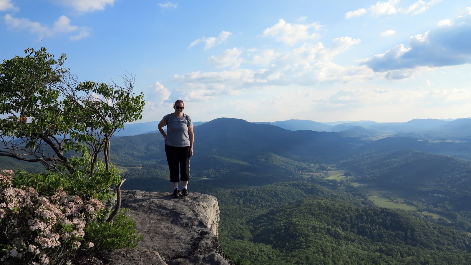
Tinker Cliffs, Roanoke, VA


Little Rocky Row Trail, George Washington NF, VA


Congress Trail, Sequoia NP, CA


Tokapah Falls Trail, Sequoia NP, CA


Emerald Lake and Pearl Lake, Sequoia NP, CA


Alta Peak, Sequoia NP, CA


High Sierra Trail, Sequoia NP, CA


John Muir Grove Trail, Sequoia NP, CA


Bearchurch Rock, Shenandoah NP, VA


Laurel Fork Special Management Area, Allegheny Highlands, VA


White Rock Falls, George Washington NF, VA


Doyles River and Jones River, Shenandoah NP, VA


Spy Rock, George Washington NF, VA


Potts Mountain, Barbours Creek Wilderness, VA


Apple Orchard Mountain, Jefferson NF, VA


Iron Mountain Trail, Mount Rogers NRA, VA


The Cascades, Giles County, VA


Devil's Marbleyard, James River Face Wilderness, VA


There were lot's and lot's more hikes. Here's 2015 being one hell of a year!

Sunday, April 19, 2015

Wild Oak Natoinal Recreation Trail and the North River Gorge

If you don't like tall trees, then this hike aint for you
Shenandoah Mountain is beautiful. Shenandoah Mountain is BIG. Shenandoah Mountain is wild. It is unique, powerful, intimidating, raw, delicate, old, and for this past weekend, it is where I called home. 

A couple months prior to this trip, we'll say around November, I got the National Geographic Trails Illustrated Map for Staunton and Shenandoah Mtn. I remember noticing on the a map a big 25 mile circuit hike called Wild Oak National Recreation Tail. As soon as I saw that, I wanted that to be the first hike to do In Shenandoah Mountain. Well, it's April now, and finally got to do this trail...well maybe half the trail. This was a 2 day backpacking trip I did. Starting off the first day following the Wild Oak NRT, and then the second day was a connection of forest roads and back trails to hike the North River Gorge. Let's start off with day 1.


Day 1: Grindstone Mountain to Camp Todd

I started off at the Wild Oak NRT trail head parking lot, just off of forest road 95. The trail is a big 25 mile loop, so I went in a counterclockwise direction. The first 7 miles of the hike is an all out assault to the top Little Bald Knob (4,350 ft). It was a difficult climb, lots of ups and downs, but mostly ups. Along the climb up there were plenty of views, rock formations, and event a small little pond.
Lookout Mountain, and Trimble Mountain


After 4.5 hours of hiking, I eventually reached Little Bad Knob. Wasn't much of view up there, but it was a great place to eat lunch. I bet it would be a great place for star gazing. It's pretty up there, with lots of camp sites.

When I reached the summit, I felt a little disappointed that there wasn't a view from the summit. You'd think, after doing a huge climb like that, there would be a huge epic view waiting for you. Well there was. Just little bit beyond the the summit, the trail goes along a cliff that hangs in a small saddle. The views were incredible!


Time to now to head down to Camp Todd for the night. The North River was running loud that night. The stars were incredibly bright. There was a group camping somewhere further down, but any sounds or noises they made were drowned out by North River. It was a very peaceful night, with temps in the mid 30's. Great time to take some star photos too.

Day 2: Flat Run and New River Gorge

After yesterday's ballbuster of hike to Camp Todd. I was in no shape to continue hiking back up along the ridge lines to do the 15 more miles needed to complete the Wild Oak Trail. So, I decided to hike some forest roads in the area, and hike some other trails in the area. The first trail I came across was the Flat Run. Flat Run is a beautiful hike through a pine forest. Under the dark canopy of the large pine trees, the understory was pretty colorful. Flat Run was running down the hill side. It's cool waters, offered a nice lunch spot.


Flat Run was only about 2 miles. After Flat Run, I walked along Forest Road 95 till and took a turn off towards Staunton Dam. Here is a good read on the history of the dam. Next it was time to begin the North River Gorge hike.

North River has very high this weekend, so making the 9 river crossings really tough. I hiked mostly with my crocks on. It was more convienent to just leave them on. Towards the last couple crossings, the water was mid thigh high. 

There was more to this hike than the numerous river crossings. The understory was just beautiful. It reminded me a lot of hiking through the High Sierras last summer. The trees were tall, and the solitude at its best. Only saw one other person!

Eventually the North River Gorge Trail intersects with the Wild Oak Trail. It was there I was able to get back to my car. I figured I had just enough time before sunset. Enough time to see a great Virginia natural landmark in the nearby area. So here you go, the sun setting on the Natural Chimneys of Virginia. Till next time, keep on hiking!


Tuesday, April 7, 2015

Bearfence Mountain and South River Falls

Fun in the sun rock scramble

Hello fellow hikers! And, welcome to the new www.lynchburgexplorer.com. As you can see, I finally bought the domain name. No more having to type lynchburgexplorer.blogspot.com to visit your favorite VA hiking blog. So what changes are in store? Well, um...maybe I might type out more of these hiking blogs, on the count I'm actually paying for this. So good news for you, I guess? 
Well, enough with website news, now let's get down to today's hike...Wait a minute, did I say 'hike'? What I should say is 'hikes'. Because, this article today, contains not one, but two beautiful hikes in Shenandoah National Park. Bearfence Mountain, and South River Falls. What a great way to spend an early April Saturday, then by exploring these two great areas. I know you'll get excited to visit these hikes, so shall we begin?

Bearfence Mountain  Hike

Bearfence Mountain is just what I needed. I was in the mood to do some good old fashion rock scrambling. But, I had a late start to the day, so Old Rag was out of the question. I figured the rock scramble on Bearfence would suffice. And boy it did. The scramble required some fancy footwork to navigate from bolder to bolder. Sometimes hands and were needed. The 360 views were outstanding from the greenstone outcrops.

Could spend all day up in heaw

Anyways, it was time to head back to my pick-up. I love to climb this mountain. It's fun and a little bit challenging. But, I still had the rest of the day to hike in other areas of the park. This is why Shenandoah is so awesome. You can have lots of fun doing these simple 1 to 2 mile hikes all up and down the Skyline Drive. You could spend a whole day, or even a whole week hiking all the many trails in this great park. So, before I get onto South River Falls hike, here's a nice breakdown of Bearfence Mountain hike:
Length: 1.2 miles

Time: 1 - 1.5 hours
Difficulty: Some nice bouldering, I wouldn't bring the little kids on this hike. There are some iffy areas.
Location: Look for the Bearfence Mountain parking lot near mile marker 56 along Skyline Drive

South River Falls

Mcguvyer would be proud
After getting back to my truck, I noticed I still had a lot of time before I wanted to begin the South River Falls hike. I was planning on seeing the waterfall more in the evening hours of the day, that way it make for great waterfall photography. So, I went a little bit down the Skyline Drive, and started hiking the Pocosin trail. About a half mile into the trail, I realized I had completely forgotten my camera tripod back home. I knew without a tripod for stability, my shots of the waterfall would come out looking blurry. So, I came up with an idea to make a tripod out of sticks and rope. I proceeded to head back to my truck, and begin trying to make my all natural camera tripod. I got a lot of funny looks carrying my homemade tripod down the trail. But, the thing worked out pretty well. It kept my camera stable while on uneven and rocky terrain. 

Now it was time for the waterfalls. There was a nice overlook along the trail that offered a view of the falls. The falls looked impressive and enormous. But, as for picture taking, the trees really blocked the view. So I took a picture as best as I could from the overlook. Eh, not the best looking photo I've taken. But, no worries. The trail does continue on down past the overlook to the base of the falls. It was from here that I was able to capture some good quality photos.


Well, Looks like the sun was hanging low. I made it to the falls, with the right kind of sunlight to take some pretty decent photos. Anyways time to head back up. I was getting hungry, so I figured I would eat dinner at the Skyland Resort. But, before I could make it the resort,  I had one more stop to make. The sun was setting, and I was on the Skyline Drive, gotta find me an overlook to watch the sun setting of the Great Valley. I'll leave you with a view I saw from the overlook, but first here's some information on the South River Hike. Enjoy, and see you next adventure!
Length: 4.4 mi

Time: 2.5 - 3 hrs
Difficulty: Pretty easy going down to the overlook. A little rocky heading to the base of the falls, not too difficult
Waterfall height: 83 feet
Location: Look for the South River Falls Picnic Area near miler marker 63. Loop around the picnic area until you see the trail head near the water fountain.